What's Beneath Your Site? How Subsurface Geology Determines Drilling Strategy—and Project Costs
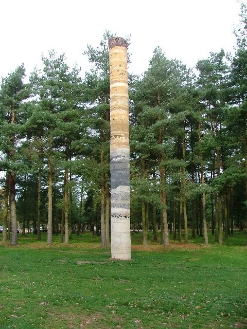
Photo: Mick Garratt, CC BY-SA 2.0, via Wikimedia Commons
When commercial developers and municipal planners think about drilling projects, the conversation typically centers on timelines, permits, and contractor bids. What often receives insufficient attention is the ground itself—specifically, what lies beneath the surface and how profoundly it governs every decision that follows. Subsurface geology is not a background variable. It is the central factor that determines which equipment is deployed, how long a project takes, and whether a budget holds.
At Salem Bore Wells, we have observed firsthand how projects launched without rigorous geological assessments encounter expensive mid-course corrections. The pattern is consistent and avoidable. This article examines the four most common subsurface formations encountered in commercial and municipal drilling across the United States, explains why each demands a fundamentally different approach, and makes the case for investing in thorough site surveys before any drilling contract is signed.
Why Geology Is Not a One-Size-Fits-All Variable
The continental United States encompasses an extraordinary range of geological conditions. A commercial development in the Texas Hill Country sits atop fractured limestone. A municipal water project in the upper Midwest may encounter dense granite beneath a thin layer of glacial till. A coastal development in the Southeast might drill through alternating layers of clay and sand. Each of these conditions presents unique engineering challenges—and each failure to anticipate them translates directly into cost overruns.
Geological site surveys—which typically include borehole logging, soil sampling, geophysical testing, and review of available regional data—provide planners with a detailed picture of what drilling crews will encounter. This information shapes equipment selection, drilling fluid choices, casing specifications, and contingency planning. Without it, project managers are effectively working blind.
Granite: The Hardest Opponent in the Ground
Granite is among the most demanding formations a drilling team can encounter. Its extreme hardness and abrasive mineral composition accelerate bit wear at a rate that surprises planners unfamiliar with igneous rock. Projects in New England, the upper Midwest, and parts of the Rocky Mountain region frequently encounter granite or granite-like crystalline basement rock.
Drilling through granite requires rotary percussion equipment, diamond-tipped or tungsten carbide bits, and a carefully managed drilling fluid program to cool bits and carry cuttings to the surface. Penetration rates are significantly lower than in softer formations—sometimes as little as five to ten feet per hour under challenging conditions. Projects that budget based on rates appropriate for sedimentary rock can see schedules extend by weeks and costs escalate substantially.
A pre-drilling geological assessment in granite-prone regions allows contractors to specify the correct equipment from the outset, set realistic penetration rate expectations, and plan for higher consumable costs. The investment in that assessment is typically a fraction of what an unprepared pivot costs mid-project.
Limestone: Fractured, Cavernous, and Unpredictable
Limestone presents a different category of challenge. Unlike granite, which is uniformly hard, limestone is chemically soluble and often riddled with fractures, voids, and karst features—underground cavities formed by centuries of water dissolving carbonate rock. The karst regions of Florida, Tennessee, Kentucky, and Texas are particularly notable for this phenomenon.
For drilling purposes, these voids create serious risks. Drill strings can drop unexpectedly into cavities, causing equipment damage and potential borehole instability. Drilling fluid circulation can be lost entirely into fractures, leading to costly fluid replacement and compromised borehole integrity. In some cases, caverns encountered during drilling require borehole abandonment and repositioning—a significant setback on any timeline.
Geological surveys in limestone regions must go beyond standard soil sampling. Ground-penetrating radar, electrical resistivity testing, and review of regional karst maps are all tools that help identify void zones before drilling begins. Repositioning a planned well location by fifty feet based on survey data costs far less than losing equipment down an undetected cavity.
Clay: Slow, Sticky, and Structurally Unstable
Clay formations are common across the Midwest, Southeast, and Pacific Northwest. While clay is not hard to drill through, it introduces a distinct set of complications that can be equally disruptive. Expansive clays—those that swell when exposed to water—can grip drill strings, slow penetration, and cause borehole collapse if not properly managed.
The drilling fluid program is critical in clay formations. Bentonite-based fluids must be carefully formulated to stabilize borehole walls without triggering excessive swelling. Casing installation must proceed promptly, as clay boreholes are prone to closure. In some regions, clay layers alternate with sand or gravel, creating stratified conditions that require casing changes at multiple depths.
For commercial projects involving deep water wells or geothermal bore installations, clay formations also affect pump performance and long-term well yield. Planners who understand these dynamics from the outset can specify appropriate well screen designs and development procedures that protect the investment over the life of the installation.
Shale: The Layered Formation That Demands Precision
Shale is a fine-grained sedimentary rock that underlies large portions of the central and eastern United States. While shale is not as hard as granite, its layered, laminated structure creates specific drilling challenges. Shale formations tend to slough—meaning that drill cuttings do not remain in place but instead break away in sheets or flakes, potentially clogging the borehole and complicating casing installation.
Additionally, shale can be reactive to water-based drilling fluids, swelling or disintegrating in ways that compromise borehole stability. Inhibitive drilling fluids—those formulated to minimize shale reactivity—are often required, adding complexity and cost to the fluid management program.
For municipal projects where shale is anticipated, proper geological assessment allows the drilling team to plan for inhibitive fluid systems, appropriate bit selection, and careful casing sequencing. These preparations do not eliminate the challenge, but they prevent it from becoming a crisis.
The Economics of Knowing Before You Drill
The financial case for pre-drilling geological surveys is straightforward. A comprehensive assessment for a commercial drilling project typically costs between $5,000 and $25,000 depending on site complexity and the extent of testing required. Mid-project pivots caused by unexpected geological conditions—equipment swaps, borehole abandonments, schedule extensions, and contractor change orders—routinely cost ten to fifty times that amount.
Beyond direct costs, geological surprises affect project timelines, which carry their own consequences. A municipal water project delayed by unexpected granite may push activation past a critical seasonal deadline. A commercial development stalled by karst complications may miss a construction window that affects tenant occupancy schedules. These downstream effects compound the financial impact of what began as an information gap.
Planning That Starts Underground
Commercial developers and municipal planners who treat geological site surveys as an optional preliminary step are taking on risk that is entirely avoidable. The subsurface conditions beneath any project site are fixed—they cannot be negotiated with or ignored. What can be managed is the quality of information available before drilling begins.
At Salem Bore Wells, our project planning process begins with a thorough review of available geological data and, where warranted, direct subsurface investigation. This approach is not procedural formality. It is the foundation on which accurate bids, realistic timelines, and successful project outcomes are built. The formations beneath your site will determine your drilling strategy. The only question is whether you learn that before or after the bit hits the ground.